

SEO title tag: Local Ecosystem Protections in Florida: A Landowner’s Guide
When Local Rules Shape the Landscape: Understanding Ecosystem Protections in Southwest Florida
You have checked for wetlands, reviewed listed-species requirements, and confirmed your project’s state permits. Does that mean you are ready to clear, grade, or build?
Not necessarily.
Federal and state environmental requirements are only part of Florida’s regulatory picture. Counties and municipalities may impose additional protections affecting native vegetation, wetlands, wildlife habitat, trees, buffers, open space, stormwater, clearing, grading, and site design.
That does not make development impossible. It does mean the rules must be evaluated at the correct level of government: and for the correct jurisdiction: before you finalize plans or begin work.
Start with the Most Important Question: Where Is the Property?
Local environmental rules are not automatically statewide rules. They may apply only within:
- A particular county
- Unincorporated county land
- A specific municipality
- A mapped conservation area, habitat area, or resource protection zone
- A defined corridor, buffer, or overlay district
A property’s mailing address is not enough. You need to know whether the parcel is inside city limits, in unincorporated county territory, or subject to a special local designation.
Why does that matter? Because the same ecosystem can be regulated differently on opposite sides of a municipal boundary.
Four layers of environmental authority
Federal requirements
Federal laws may apply to federally listed species and federally regulated waters. The U.S. Fish and Wildlife Service generally handles terrestrial species protected under the Endangered Species Act, while NOAA Fisheries has authority over certain marine species.
For federally regulated wetlands and other waters, the U.S. Army Corps of Engineers may have a role in Section 404 permitting. Federal jurisdiction is fact-specific and should not be assumed from the general federal or state wetland maps available online. These maps are useful screening tools, but they are broad, unverified planning resources—not field-verified wetland delineations or final jurisdictional determinations.
State requirements
Florida’s state framework includes:
- Environmental Resource Permits administered through the Florida Department of Environmental Protection and applicable water management districts
- State wetland and surface-water protections
- State-listed species protections administered by the Florida Fish and Wildlife Conservation Commission
- State requirements involving stormwater, drainage, erosion, and water quality
The agencies and permits involved may vary by location and project type. For example, Southwest Florida includes areas within both the Southwest Florida Water Management District and the South Florida Water Management District.
County requirements
Counties may regulate land clearing, native habitats, tree removal, wetland buffers, development intensity, open space, and local environmental review.
These requirements can apply even when a separate state or federal permit is not required.
Municipal requirements
Cities may have their own comprehensive plans, land-development codes, tree ordinances, landscaping standards, and site-plan review procedures.
County approval does not automatically authorize work inside a municipality. Conversely, county rules may apply to a property near a city if the parcel is outside the city boundary.
Sarasota County: A Key Southwest Florida Example
Sarasota County demonstrates why local research is essential.
The county has a regulatory framework for protected native habitats and ecological systems. Examples of habitat types recognized in the county’s planning and development framework may include:
- Wetland and upland native communities
- Mesic flatwoods and hydric hammock
- Dry prairie and basin marshes
- Coastal hammocks
- Beaches and dune systems
- Tidal salt marsh and mangrove swamp
- Marine and estuarine consolidated substrate
These categories are not simply biological descriptions. Depending on the project and location, they may affect preservation areas, buffers, site layout, clearing, filling, excavation, and required conservation documentation.
Unincorporated Sarasota County is not the City of North Port
This distinction is critical.
Sarasota County’s protected habitat requirements are a concern in unincorporated Sarasota County. They do not apply within the City of North Port.
A parcel near North Port may still be in unincorporated Sarasota County, however. In that situation, county rules: not city rules: may control the local environmental review.
Property owners inside North Port should work with the city to determine which municipal standards apply. Do not assume that a county habitat designation, buffer, or permit process transfers directly into the city.
Sarasota County may use more than one classification approach
Sarasota County may require applicants to describe ecosystems using county habitat categories or FLUCCS, depending on the project and review process.
That is different from saying every project uses the same classification system.
A county reviewer may rely on mapped native habitats, an applicant’s ecological assessment, FLUCCS codes, or a combination of information. The required format can depend on the type of application, the location, and the reviewing department.
A map label is not the same thing as a final site determination. Field conditions, property boundaries, wetland lines, historical disturbance, and current regulations still matter.
The planned follow-up article will compare Florida’s overlapping ecosystem and land-cover classification systems, including FLUCCS, FNAI, and the Florida Land Cover Classification System, or CLC. This article focuses on the broader question: what local protections may affect your project?

What Local Sarasota Requirements Can Mean for Your Project
In unincorporated Sarasota County, development proposals affecting native habitats may be evaluated using an avoidance, minimization, and preservation sequence.
In plain English:
- Avoid sensitive resources where practical.
- Minimize the size or severity of unavoidable impacts.
- Preserve remaining protected habitat through an approved mechanism.
That mechanism may include a preserve area, restrictive covenant, conservation easement, or similar recorded documentation.
Wetland buffers may also apply. The county framework commonly identifies a 30-foot minimum buffer around wetlands, with wider requirements associated with certain communities such as mesic hammock. Exact requirements depend on the current code, habitat type, and project circumstances.
Additional local review may apply near the Myakka River, including properties within defined areas covered by the county’s Myakka River protection provisions.
Before disturbing vegetation, filling, excavating, storing materials, or grading near a protected area, review:
- The current county code
- Recorded conservation easements and restrictive covenants
- Approved plats and development orders
- County habitat maps
- Applicable buffer and preserve requirements
- Any project-specific conditions of approval
For current information, consult Sarasota County’s Environmental Permitting and Projects resources.
Charlotte County and Other Southwest Florida Jurisdictions
Sarasota County is not the only jurisdiction where environmental review can affect site design and permitting.
Charlotte County, for example, publishes a Guide to Environmental Permitting that is useful as a practical overview of overlapping county, state, and federal environmental issues that may affect a project.
That distinction matters.
Topics such as tree removal, wetlands, listed species, gopher tortoises, buffers, and vegetation clearing are not uniquely Charlotte County issues. They are the same or similar environmental-review questions you may encounter in many Florida counties, and much of the underlying authority may come from state or federal law, not just county code.
In other words, if your project raises questions about wetlands, protected species, or tortoise impacts, you should not assume Charlotte County created the entire regulatory framework. Often, the county review exists alongside separate requirements administered by agencies such as FWC, FDEP, a water management district, USFWS, or the U.S. Army Corps of Engineers.
The Charlotte County-specific issue that deserves particular attention is the Countywide Florida Scrub-jay Habitat Conservation Plan (HCP). That local program is an important exception because it creates a county-level framework for addressing scrub-jay impacts in Charlotte County, and it can directly affect how qualifying projects move forward.
Charlotte County’s local process may therefore involve a mix of:
- Tree-removal or vegetation-clearing authorization
- Wetland and surface-water review
- Upland buffers
- Listed-species considerations
- The Countywide Florida Scrub-jay Habitat Conservation Plan
- Gopher tortoise avoidance or permitting
- Local development conditions
However, Charlotte County’s standards are not statewide law, and not every item in its guide is purely a county requirement. Lee, Collier, Manatee, DeSoto, and other jurisdictions may use different definitions, thresholds, maps, permits, and review procedures, while still dealing with many of the same underlying state and federal environmental issues.
Even within one county, requirements can differ between incorporated cities and unincorporated areas.
Wetlands, Habitat, and the Cost of Late Discoveries
Wetland permitting is often one of the most consequential issues for a Florida project.
A wetland determination typically considers vegetation, hydrology, and soils. State delineation procedures are addressed in Chapter 62-340, Florida Administrative Code, while project authorization may involve the appropriate water management district, FDEP, and potentially federal agencies.
A project may require:
- A wetland delineation
- An Environmental Resource Permit
- Federal waters analysis
- Avoidance and minimization measures
- Mitigation for unavoidable impacts
- Revised drainage or stormwater plans
- Conservation easements or monitoring
Mitigation is not simply replacing an acre with another acre. It is generally intended to offset lost ecological functions through preservation, restoration, enhancement, creation, or approved mitigation-bank credits.
Why plan this early? Because a wetland line discovered after engineering is complete can force a building footprint, road, pond, or utility corridor to move. That can affect grading, stormwater design, access, lot yield, construction costs, and the project schedule.
Ecosystem Protection Extends Beyond Listed Species
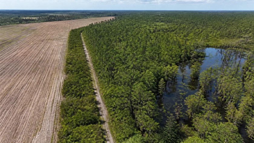
The wetland, habitat, and local-review issues discussed above are not important only because they may shelter listed species.
They also matter because wetlands, native communities, and connected landscape features perform broader ecological functions that support water, soil, vegetation, and wildlife systems across an area. In practical terms, that means local environmental review may matter even when a listed-species issue is not the main driver.
A native ecosystem may provide:
- Groundwater recharge
- Surface-water filtration
- Flood storage
- Soil stability and nutrient cycling
- Air-quality benefits
- Habitat connectivity
- Pollinator resources
- Protection from invasive species
- Resilience during drought, storms, and changing conditions
A native ecosystem is better understood as a living infrastructure network: soils, water, vegetation, fungi, invertebrates, reptiles, birds, and mammals interact across connected spaces, often extending beyond a single property boundary.
The Florida Fish and Wildlife Conservation Commission’s Avoidance and Permitting guidance explains that advance planning can help avoid impacts to protected species and essential habitat. Depending on the species and project, surveys, seasonal restrictions, buffers, relocation, mitigation, or state or federal permits may be needed.
A species survey does not replace a wetland permit. A wetland permit does not replace local tree approval. Each regulatory question must be matched to the agency and jurisdiction that controls it.
A Practical Early-Review Plan
Before purchasing land, clearing vegetation, or committing to a final site plan, you should:
-
Confirm jurisdiction
- Is the parcel in a city or unincorporated county?
- Which county and municipality review local approvals?
- Which water management district covers the property?
-
Review available mapping
- Wetlands and surface waters
- Soils and hydrology
- Native habitat
- Listed-species potential
- Tree or canopy-road designations
- Flood and stormwater constraints
-
Inspect the site
- Conduct an ecological evaluation rather than relying only on desktop maps.
- Identify wetlands, native communities, wildlife signs, burrows, nests, and existing disturbances.
-
Check recorded restrictions
- Conservation easements
- Preserve areas
- Restrictive covenants
- Plat notes
- Prior development orders
-
Design around the most sensitive areas first
- Avoid impacts where possible.
- Reduce the size and intensity of unavoidable impacts.
- Identify mitigation and long-term management needs early.
-
Confirm agency expectations
- Ask the applicable county, city, FDEP, water management district, FWC, USFWS, or USACE what documentation is needed.
- Obtain written clarification when an issue is uncertain.
-
Build time into the schedule
- Surveys may be seasonally limited.
- Agency reviews may take weeks or months.
- Mitigation availability, redesign, and conservation-document preparation can add additional time.
How Natural Resources Associates Can Help
Natural Resources Associates helps landowners, farmers, ranchers, developers, and permit applicants understand environmental constraints before they become expensive surprises.
Our services may include:
- Initial ecological evaluations
- Ecosystem and wildlife surveys
- Wetland and habitat coordination
- Listed-species permitting strategy
- Avoidance and minimization planning
- Local, state, and federal permitting coordination
- Agricultural and land-management planning
- Communication with reviewing agencies
We do not replace the authority of a county, city, state agency, or federal agency. Our role is to help you assemble accurate information, identify the right questions, and make practical decisions before work begins.
Bottom Line: Local Rules Deserve Early Attention
Federal and state permits do not tell the whole story.
The county or municipality may impose additional requirements that affect your property’s trees, native vegetation, wetlands, buffers, habitat, open space, clearing, grading, and site design. Those requirements can vary across jurisdictional boundaries and may change the feasibility, cost, or timing of a project.
A proactive ecological review is not anti-development. It is a way to create certainty.
Sometimes the best result is preserving a valuable ecosystem. Sometimes it is shifting a building pad, narrowing a clearing area, or redesigning a stormwater feature. It can never make everyone happy: but early planning can often create a workable, balanced solution.
If you are evaluating land or preparing a project in Central or Southern Florida, contact Natural Resources Associates before clearing or finalizing your site plan.
Helpful Resources
- Sarasota County Environmental Permitting and Projects
- Florida DEP Wetland Permitting Guide
- Southwest Florida Water Management District
- Florida Fish and Wildlife Conservation Commission: Avoidance and Permitting
- U.S. Fish and Wildlife Service Florida Project Planning Resources
- Charlotte County Guide to Environmental Permitting
- Florida Scrub-Jay Permitting
- State Waters vs. Waters of the United States in Florida